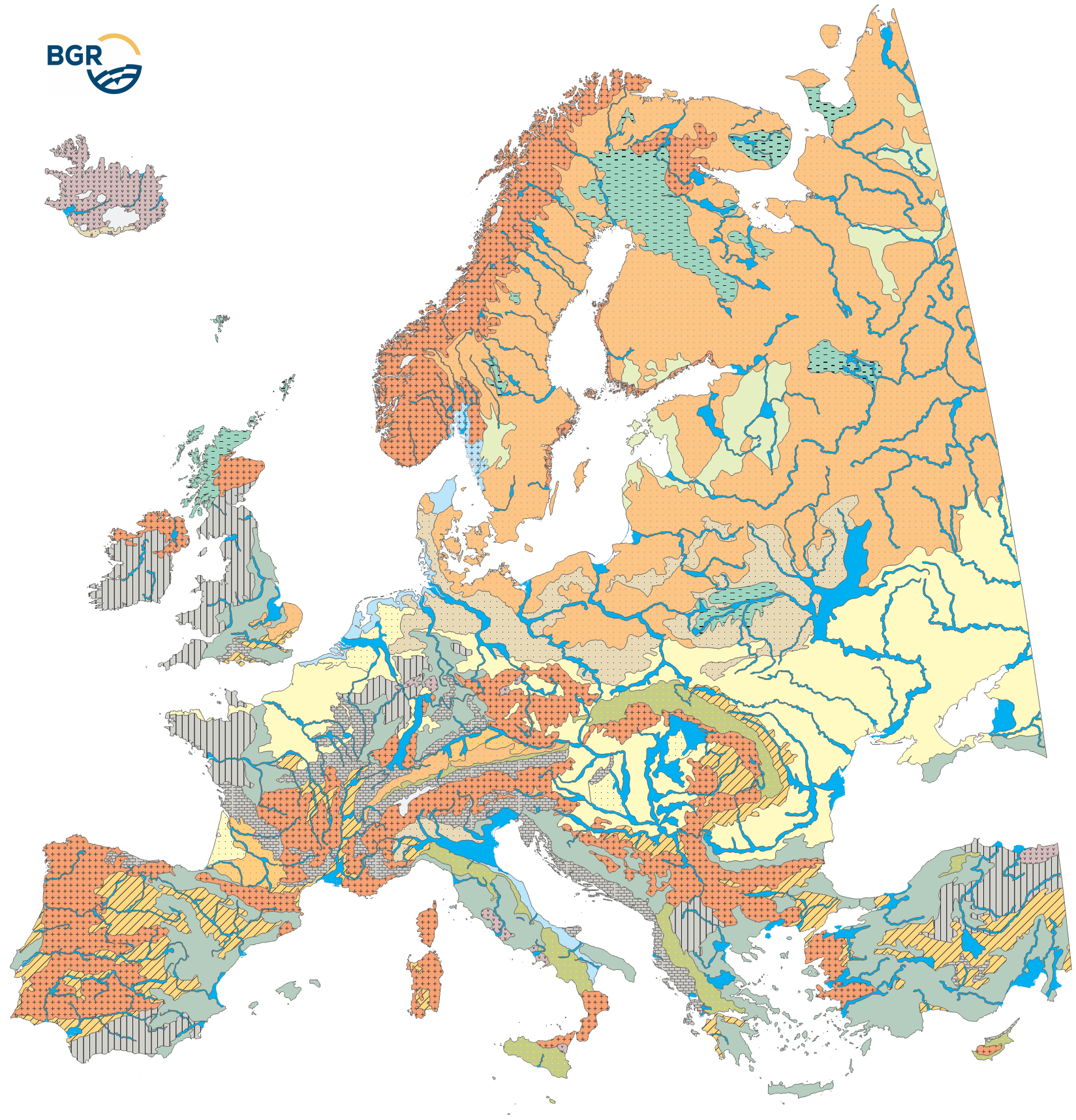
For the legend-building of the soil regions map (EUSR5000), areas with similar climate (EUCA15000) are further subdivided into areas with similar parent material, thus with a similar geologic paleogeographic development. Because the geological conditions (nature of parent material) are key factors for soil formation, it must be characterized at the level of the soil regions as well. In order to represent parent material at the Europe-wide continental level, data from small-scale geological maps were re-interpreted and aggregated to parent material associations 1:15 Mio. The different rocks are summarized by geological formation, at the same time following the main class- or group-level from the List of Parent Material according to Finke et al.(2001). As a result, 18 rock complexes were received and evaluated in respect of their effect on soil formation. Here it must be pointed out that soils are not formed on the rock itself but on weathering products mostly consisting of several layers and with numerous external components incorporated by redeposition. Für die Legendenerstellung der der Karte der Bodenregionen (EUSR5000) werden Gebiete mit ähnlichem Klima (EUCA15000) weiter unterteilt in Gebiete mit ähnlichem Ausgangsmaterial und somit mit einer ähnlichen geologischen paläogeografischen Entwicklung. Da die geologischen Bedingungen (Beschaffenheit des Ausgangsmaterials) entscheidende Faktoren für die Bodenbildung sind, müssen sie auch auf der Ebene der Bodenregionen charakterisiert werden. Um das Ausgangsmaterial auf europäischer Kontinentalebene darzustellen, wurden Daten aus kleinmaßstäbigen geologischen Karten neu interpretiert und zu Ausgangsmaterialassoziationen im Maßstab 1:15 Mio. zusammengefasst. Die verschiedenen Gesteine werden nach geologischen Formationen zusammengefasst, wobei gleichzeitig die Hauptklassen- oder Gruppenebene aus der Liste der Ausgangsmaterialien nach Finke et al. (2001) berücksichtigt wird. Im Ergebnis wurden 18 Gesteinskomplexe erhalten und hinsichtlich ihres Einflusses auf die Bodenbildung bewertet. Dabei ist zu beachten, dass Böden nicht auf dem Gestein selbst entstehen, sondern auf Verwitterungsprodukten, die meist aus mehreren Schichten bestehen und zahlreiche durch Umlagerung eingebrachte Fremdkomponenten enthalten.
Raumbezug
Lage der Geodaten (in WGS84)
| SW Länge/Breite | NO Länge/Breite | |
|---|---|---|
| -35.181°/31.886° | 67.021°/74.147° |
| Koordinatensystem |
|---|
Verweise und Downloads
Downloads (3)
Nutzung
| Nutzungsbedingungen |
General Standard Terms and Conditions (GSTC) of the Federal Institute for Geosciences and Natural Resources (BGR). The LBEG or the BGR is the owner of the rights of exploitation for software, digital data, and other products protected by copyright, as well as know-how. The contractual partner receives a simple right of use for the types of use defined in the following. The right to duplicate and present is also transferred. The rights which are not transferred include in particular the right to make accessible to the public, unless the contractual partner makes the aforementioned accessible to the public within the framework of an administrative procedure when acting as a participating authority in said administrative procedure. For the purpose of reuse the provided information has to be quoted as follows: BGR [Bundesanstalt für Geowissenschaften und Rohstoffe] (2005). Soil Regions Map of the European Union and Adjacent Countries 1:5,000,000 (Version 2.0). Special Publication, Ispra. EU catalogue number S.P.I.05.134. |
|---|
| Zugriffsbeschränkungen |
no limitations to public access |
|---|
Kontakt
Fachinformationen
Informationen zum Datensatz
| Identifikator |
acd77c46-c706-ee1b-739d-45181dc7c397 |
|---|
| Digitale Repräsentation |
Vector |
|---|
Erstellungsmaßstab
| Maßstab 1:x |
15000000 |
|---|
| Fachliche Grundlage |
Die Datenquellen sind in Hartwich et al. (2005) gelistet und erläutert: - Europaweite thematische Karten und Datensätze - Nationale/regionale Bodenkarten und Expertenwissen von Mitgliedern des European Soil Bureau Network (ESBN) - The data sources are listed, explained and cited in Hartwich et al. (2005): - Europe-wide thematic maps and data sets - national/regional soil maps and expert knowledge from members of the European Soil Bureau Network (ESBN) |
|---|
Informationen zum Metadatensatz
| Objekt-ID |
fdcdd096-d8f6-4a98-bd03-861c9772b3b1 |
|---|
| Aktualität der Metadaten |
11.09.2025 |
|---|
| Sprache Metadatensatz |
Englisch |
|---|
| Datensatz / Datenserie |
Dataset |
|---|
| XML Darstellung |
|---|
| Point of Contact (Metadatum) |
|---|
| Metadatenquelle |
GeoDaK (Datenkatalog der Bundesanstalt für Geowissenschaften und Rohstoffe)
|
|---|---|
|
Bundesanstalt für Geowissenschaften und Rohstoffe
|


