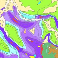
The “Geological Map of Germany 1:1,000,000 OneGeology-Europe (GK1000-1GE)” shows Germany’s surface geology: All geological units are described by their age (stratigraphy) and composition (lithology). The geological units and terms used in this map were semantically harmonized within the OneGeology-Europe project and have been - in a number of regions - geometrically and semantically made consistent with the neighbouring OneGeology-Europe participants. Die "Geologische Karte 1:1.000.000 OneGeology-Europe (GK1000-1GE)" zeigt die Oberflächengeologie Deutschlands: Alle geologischen Einheiten werden auf der Grundlage ihres Alters (Stratigraphie) und ihrer Zusammensetzung (Lithologie) charakterisiert. Geologische Einheiten und Begriffe, die in dieser digitalen Karte verwendet werden, wurden im Rahmen des Projekts OneGeology-Europe semantisch harmonisiert und – in einigen ausgewählten Regionen – mit benachbarten OneGeology-Europe Mitgliedern geometrisch und semantisch aufeinander abgestimmt.
Raumbezug
Lage der Geodaten (in WGS84)
| SW Länge/Breite | NO Länge/Breite | |
|---|---|---|
| 5.5°/47.25° | 15.5°/55.0° |
| Koordinatensystem |
|---|
Verweise und Downloads
Querverweise (1)
Geodatensatz
Geological Map of Germany 1:1,000,000 OneGeology-Europe (GK1000-1GE)
The “Geological Map of Germany 1:1,000,000 OneGeology-Europe (GK1000-1GE)” shows Germany’s surface geology: All geological units are described by their age (stratigraphy) and composition (lithology). The geological units and terms used in this map were semantically harmonized within the OneGeology-Europe project and have been - in a number of regions - geometrically and semantically made consistent with the neighbouring OneGeology-Europe participants.
Nutzung
| Nutzungsbedingungen |
General terms and conditions, see https://www.bgr.bund.de/AGB_en - Allgemeine Geschäftsbedingungen, s. https://www.bgr.bund.de/agb. In case of reuse the information provided should be cited as follows: "Data Source: OneGeology-Europe harmonized geology, (c) BGR Hanover, 2018" |
|---|
| Zugriffsbeschränkungen |
no limitations to public access |
|---|
Kontakt
Fachinformationen
Informationen zum Datensatz
| Art des Dienstes |
View Service |
|---|
| Version |
OGC:WMS 1.3.0 |
|---|
| Fachliche Grundlage |
This dataset is based on the Geological Map of Germany 1:1,000,000 (GK1000). |
|---|
Operation
| Name der Operation | Beschreibung der Operation | Aufruf der Operation | |
|---|---|---|---|
| GetCapabilities |
https://services.bgr.de/wms/geologie/BGR_EN_Surface_Geology/? |
||
| GetMap |
https://services.bgr.de/wms/geologie/BGR_EN_Surface_Geology/? |
||
| GetCapabilities Dokument | Kartenansicht öffnen |
|---|
Zusatzinformationen
Konformität
| Spezifikation der Konformität | Spezifikationsdatum | Grad der Konformität | Geprüft mit |
|---|---|---|---|
| VERORDNUNG (EG) Nr. 976/2009 DER KOMMISSION vom 19. Oktober 2009 zur Durchführung der Richtlinie 2007/2/EG des Europäischen Parlaments und des Rates hinsichtlich der Netzdienste | 20.10.2009 | See the referenced specification |
Datenformat
| Name | Version | Kompressionstechnik | Spezifikation |
|---|---|---|---|
| png | n/a | ||
| jpeg | n/a | ||
| gif | n/a |
Informationen zum Metadatensatz
| Objekt-ID |
908b2f4f-5b3a-47cb-9b40-6f76c9db5389 |
|---|
| Aktualität der Metadaten |
17.10.2025 |
|---|
| Sprache Metadatensatz |
Englisch |
|---|
| XML Darstellung |
|---|
| Point of Contact (Metadatum) |
|---|
| Metadatenquelle |
GeoDaK (Datenkatalog der Bundesanstalt für Geowissenschaften und Rohstoffe)
|
|---|---|
|
Bundesanstalt für Geowissenschaften und Rohstoffe
|


