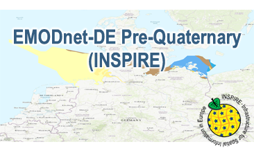
Compilation of the European Pre-Quaternary marine geology (section of Germany). Project partners are the national geological services of the participating countries. The map consists of data at highest available spatial resolution, map scale („multi-resolution“-concept) and data completeness vary depending on the project partner (as of 2016 September). According to the Data Specification on Geology (D2.8.II.4_v3.0) the content of the geological map is stored in a INSPIRE-compliant GML file: EMODnet-DE_Pre-Quaternary_GeologicUnit.gml contains the geologic units. The GML files together with a Readme.txt file are provided in ZIP format (EMODnet-DE_Pre-Quaternary-INSPIRE.zip). The Readme.text file (German/English) contains detailed information on the GML file content. Data transformation was proceeded by using the INSPIRE Solution Pack for FME according to the INSPIRE requirements. Zusammenstellung des Prä-Quartärs der marinen Geologie Europas (deutscher Ausschnitt). Projektpartner sind die nationalen geologischen Dienste der beteiligten Länder. Die Karte enthält die verfügbaren Daten mit der jeweils höchsten Auflösung der Meeresgebiete der europäischen Projektpartner. Sowohl die räumliche Auflösung („multi-resolution“-Ansatz) als auch die Gebietsabdeckung variieren je nach Projektpartner und beruhen auf der Verfügbarkeit der Daten und dem aktuellen Kartierungsstand (Stand Sept. 2016). Entsprechend der Datenspezifikation Geology (D2.8.II.4_v3.0) liegen die Inhalte der Karte in einer INSPIRE-konformen GML-Datei vor: EMODnet-DE_Pre-Quaternary_GeologicUnit.gml beinhaltet die geologischen Einheiten. Die GML-Datei wird zusammen mit einer Readme.txt-Datei im ZIP-Format (EMODnet-DE_Pre-Quaternary-INSPIRE.zip) bereitgestellt. Die Readme-Textdatei (Deutsch/Englisch) enthält Detailinformationen zum Inhalt der GML-Datei. Die Datentransformation erfolgte entsprechend der INSPIRE-Vorgaben mit dem INSPIRE Solution Pack for FME.
Raumbezug
Lage der Geodaten (in WGS84)
| SW Länge/Breite | NO Länge/Breite | |
|---|---|---|
| 3.3°/53.1° | 14.75°/56.0° |
| Koordinatensystem |
|---|
Verweise und Downloads
Downloads (1)
EMODnet-DE Pre-Quaternary (INSPIRE) (INSPIRE-GML)
EMODnet-DE Pre-Quaternary (INSPIRE) im Format INSPIRE-GML
[1.0 MB]
Querverweise (2)
predefined ATOM
Geodatendienst
Download Service (predefined ATOM) der Bundesanstalt für Geowissenschaften und Rohstoffe (BGR)
Dieser Downloaddienst stellt die von INSPIRE betroffenen und die INSPIRE-konformen Produkte der Bundesanstalt für Geowissenschaften und Rohstoffe (BGR) bereit.
WMS
Geodatendienst
INSPIRE: EMODnet-DE - Offshore Geology - Pre-Quaternary (EMODnet-DE Pre-Quaternary) (WMS)
Compilation of the European Pre-Quaternary marine geology (section of Germany). Project partners are the national geological services of the participating countries. The map consists of data at highest available spatial resolution, map scale („multi-resolution“-concept) and data completeness vary depending on the project partner (as of 2016 September). According to the Data Specification on Geology (D2.8.II.4_v3.0) the geological map provides INSPIRE-compliant data. The WMS EMODnet-DE Pre-Quaternary (INSPIRE) contains layers of the geologic units (GE.GeologicUnit) displayed correspondingly to the INSPIRE portrayal rules. The geologic units are represented graphically by stratigraphy (GE.GeologicUnit.AgeOfRocks) and lithology (GE.GeologicUnit.Lithology). The portrayal of the lithology is defined by the first named rock or rock group. Via the getFeatureInfo request the user obtains detailed information on the lithology, stratigraphy (age) and genesis (event environment and event process).
Kartenansicht öffnen
Weitere Verweise (1)
https://services.bgr.de/inspire/emodnet_prequaternary
Information
Karte im BGR-Geoviewer
Nutzung
| Nutzungsbedingungen |
Nutzungsbestimmungen für die Bereitstellung von Geodaten des BundesQuellenvermerk: Bundesanstalt für Geowissenschaften und Rohstoffe (BGR) General Terms and Conditions, s. https://www.bgr.bund.de/agb_en Dieser Datensatz kann gemäß der "Nutzungsbestimmungen für die Bereitstellung von Geodaten des Bundes" (https://sg.geodatenzentrum.de/web_public/gdz/lizenz/geonutzv.pdf) genutzt werden. |
|---|
| Zugriffsbeschränkungen |
no limitations to public access |
|---|
Kontakt
Fachinformationen
Informationen zum Datensatz
| Digitale Repräsentation |
Vector |
|---|
| Fachliche Grundlage |
The EMODnet-DE Pre-Quaternary (INSPIRE) GML file based on the spatial dataset of BGR Emodnet 2 – Offshore Geology transformed according to INSPIRE. |
|---|
Zusatzinformationen
| Sprache des Datensatzes |
Englisch |
|---|
Konformität
| Spezifikation der Konformität | Spezifikationsdatum | Grad der Konformität | Geprüft mit |
|---|---|---|---|
| INSPIRE Data Specification on Geology - Technical Guidelines | 10.12.2013 | See the referenced specification | |
| VERORDNUNG (EG) Nr. 1089/2010 DER KOMMISSION vom 23. November 2010 zur Durchführung der Richtlinie 2007/2/EG des Europäischen Parlaments und des Rates hinsichtlich der Interoperabilität von Geodatensätzen und -diensten | 08.12.2010 | See the referenced specification |
Datenformat
| Name | Version | Kompressionstechnik | Spezifikation |
|---|---|---|---|
| INSPIRE-GML | n/a |
Informationen zum Metadatensatz
| Objekt-ID |
030a8d04-94af-4ca5-b3db-2aac8c064d59 |
|---|
| Aktualität der Metadaten |
09.04.2024 |
|---|
| Sprache Metadatensatz |
Englisch |
|---|
| Datensatz / Datenserie |
Dataset |
|---|
| XML Darstellung |
|---|
| Point of Contact (Metadatum) |
|---|
| Metadatenquelle |
GeoDaK (Datenkatalog der Bundesanstalt für Geowissenschaften und Rohstoffe)
|
|---|---|
|
Bundesanstalt für Geowissenschaften und Rohstoffe
|


