Suche Karten Messwerte Kataloge Über NUMIS Anbieter Datenquellen API
Hilfe Kontakt Inhalt Impressum Datenschutz Barrierefreiheit
NUMIS - Das niedersächsische Umweltportal NUMIS - Das niedersächsische Umweltportal
Suche
Karten
Messwerte
Kataloge
API
Alle Suchergebnisse
Geodatensatz

Processed seismic data of Cruise BGR98 1998

Inhalt
  • Übersicht
  • Be­schrei­bung
    Aktualität des Datensatzes
  • Raumbezug
  • Verweise und Downloads
    Downloads Weitere Verweise
  • Nutzung
  • Kontakt
    Point of Contact
  • Fach­informationen
    Informationen zum Datensatz Zusatzinformationen Schlag­worte
  • Metadatensatz

Downloads (1)

BGR98 1998 (Shapefile) BGR98 1998 im Format ESRI Shape [3.0 MB]

Nutzungs­bedingun­gen

Allgemeine Geschäftsbedingungen, siehe http://www.bgr.bund.de/AGB - General terms and conditions, see http://www.bgr.bund.de/AGB_en. Die bereitgestellten Informationen sind bei Weiterverwendung wie folgt zu zitieren: Datenquelle: BGR98 1998, (c) BGR, Hannover, 2018

Point of Contact

Federal Institute for Geosciences and Natural Resources

Marine_Seismik@bgr.de

Vorschau

img

Be­schrei­bung

BGR98 1998

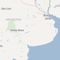
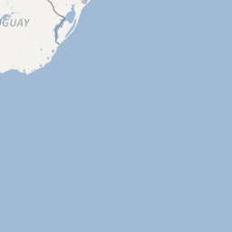
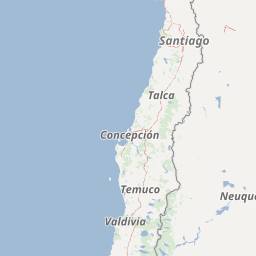
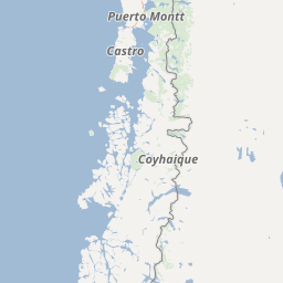
From 24th November 1998 to 24th February 1999 BGR in cooperation with YPF (Yacimientos Petrolíferos Fiscales) and SHN (Servicio de Hidrografía Naval) conducted three seismic surveys along the passive continental margin of Argentine. The seismic vessel M/V Akademik Lazarev which is operated by SMNG (Sevmorneftegeofizika) was used for these cruises. Although the seafloor spreading history of the South Atlantic Ocean is very well defined, the development of the continental margins poses still great problems to a profound understanding. When break-up of Gondwana started in Middle Jurassic, South Africa and South America remained connected. Their break-up started in Early Cretaceous, possibly propagating from south to north. Before break-up, huge tholeiitic flood basalts were extruded near the future rift, namely the Paraná basalts in Brazil and the Etendeka basalts in Namibia. It is likely that these basalts are caused by a large mantle plume. As the flood basalts were predecessors to the break-up, often a causal relationship is assumed. The dipping reflector sequences along large parts of the continental margins of South America and South Africa are interpreted as indications of the plume influence. Investigations along many passive margins have meanwhile shown that dipping reflector sequences exist along most of them. These so-called volcanic margins are the normal ones, the non-volcanic margins are the exception. For many years, it had been assumed that the hydrocarbon potential of volcanic margins is very low. The discovery of the Kudu gas field has demonstrated that this assumption is not valid in general. This increases our interest in continuing the investigation of volcanic passive margins and the variability of their structure along strike. BGR has carried out already two marine geophysical cruises off Argentina, namely with M/V EXPLORA in 1985 and with FS SONNE in 1993. These surveys had shown locally the existence of threefold dipping reflector sequences (Hinz et al., 1999). Furthermore, it had turned out that not everywhere they are accompanied by the strong magnetic G anomaly (Rabinowitz & LaBrecque, 1979). The main objectives of the BGR98 cruise were: (1) Investigation and mapping of the zone of the seaward dipping reflectors (SDR) (reflection + refraction seismic) (2) Investigation of the sedimentary column within this zone (reflection seismic) (3) Setting up a seismostratigraphy based on the seismic records obtained during the cruise and the information from the previous cruises (BGR87, SO85) as well as on additional well information (4) Comparison of the argentine seismic data with seismic data of the conjugate volcanic margin off Namibia (BGR 87). The study area is located offshore Argentine, extending from about 37° 20' S to 45° 40' S and from about 61° 10' W to 52° 00' W. It comprises the Colorado Basin as well as the outermost shelf, slope and rise of the continental margin with water depths up to 5000 m. In der Zeit vom 24.11.1998 bis 24.02.1999 hat die BGR drei Expeditionen im Bereich des argentinischen Kontinentrandes durchgeführt. Kooperationsparter hierbei waren YPF (Yacimientos Petrolíferos Fiscales) und SHN (Servicio de Hidrografía Naval). Als Plattform für die Arbeiten diente das Seismik-Schiff MS Akademik Lazarev von SMNG (Sevmorneftegeofizika). Obwohl viele Details der ozeanische Entwicklungsgeschichte des Südatlantiks bekannt sind, ist der Prozess des initialen kontinentalen Aufbrechens noch weitgehend unverstanden. Beim Zerbrechen von Gondwana im mittleren Jura waren Südamerika und das südliche Afrika noch verbunden. Hier begann das Aufbrechen in der frühen Kreide und setzte sich von Süden nach Norden fort. Vor dem Aufbrechen wurden großräumig Flutbasalte abgelagert – die Parana-Basalte in Brasilien und die Etendeka-Basalte in Namibia. Die Ursache dieser Basalte wird im unteren Mantel vermutet. Als weiteres Anzeichen dieser magmatischen Anomalie finden sich seewärts einfallende Reflektorfolgen sowohl am südamerikanischen als auch am südafrikanischen Kontinentrand. Diese Reflektorfolgen finden sich weltweit an einer Vielzahl passiver Kontinentränder, so dass der vulkanisch geprägte passive Kontinentrand als der Normalfall zu betrachten ist. Generell wurde das Kohlenwasserstoff-Potential von vulkanischen Rändern als gering eingestuft. Die Entdeckung des Kudu-Gasfeldes vor Namibia zeigte jedoch, dass diese Aussage nicht generell gültig ist. Diese Tatsache ist Ausgangspunkt für die von der BGR durchgeführte systemtische Erkundung ausgewählter vulkanischer Ränder. Vorhergehende Forschungsarbeiten vor Argentinien wurden 1985 mit MS Explora und 1993 mit FS Sonne durchgeführt. Diese Untersuchungen zeigten, dass die seewärts einfallenden Reflektoren in drei Sequenzen unterteilt werden können, und das die begleitende magnetische G-Anomalie unterschiedlich stark ausgeprägt ist. Die Hauptarbeitspunkte der Untersuchungen in 1998/1999 waren: (1) Detaillierte Kartierung der Zonen mit seewärts einfallenden Reflektorfolgen (SDRs) (2) Abbildung der sedimentären Säule (3) Entwicklung eines darauf aufbauenden seismostratigraphischen Prinzips (4) Vergleich zum konjugierenden Kontinentrand vor Namibia Das Untersuchungsgebiet vor Argentinien erstreckt sich von 37° 20' S bis 45° 40' S und von 61° 10' W bis 52° 00' W. Es enthält sowohl das Colorado Becken als auch den äußeren Schelf und erstreckt sich über den Kontinenthang bis hin zu Wassertiefen von 5000 m.

Aktualität des Datensatzes

Creation

24.02.1999

Status

completed

Raumbezug

+−
Leaflet | Copyright © Omniscale, Kartendaten: OpenStreetMap (Lizenz: ODbL)
Lage der Geodaten (in WGS84)
SW Länge/Breite NO Länge/Breite
-61.226°/-44.889° -52.2°/-37.696°
Koordinaten­system
EPSG:4326

Verweise und Downloads

Downloads (1)

BGR98 1998 (Shapefile) BGR98 1998 im Format ESRI Shape [3.0 MB]

Weitere Verweise (53)

http://www.geo-seas.eu/v_cdi_v3/print_ajax.asp?n_code=1282172 Information Profile BGR98-001A
http://www.geo-seas.eu/v_cdi_v3/print_ajax.asp?n_code=1282173 Information Profile BGR98-001B
http://www.geo-seas.eu/v_cdi_v3/print_ajax.asp?n_code=1282174 Information Profile BGR98-001C
http://www.geo-seas.eu/v_cdi_v3/print_ajax.asp?n_code=1282175 Information Profile BGR98-001
http://www.geo-seas.eu/v_cdi_v3/print_ajax.asp?n_code=1282176 Information Profile BGR98-002A
http://www.geo-seas.eu/v_cdi_v3/print_ajax.asp?n_code=1282177 Information Profile BGR98-002
http://www.geo-seas.eu/v_cdi_v3/print_ajax.asp?n_code=1282178 Information Profile BGR98-004A
http://www.geo-seas.eu/v_cdi_v3/print_ajax.asp?n_code=1282179 Information Profile BGR98-004
http://www.geo-seas.eu/v_cdi_v3/print_ajax.asp?n_code=1282180 Information Profile BGR98-005A
http://www.geo-seas.eu/v_cdi_v3/print_ajax.asp?n_code=1282181 Information Profile BGR98-005
http://www.geo-seas.eu/v_cdi_v3/print_ajax.asp?n_code=1282182 Information Profile BGR98-006
http://www.geo-seas.eu/v_cdi_v3/print_ajax.asp?n_code=1282183 Information Profile BGR98-007
http://www.geo-seas.eu/v_cdi_v3/print_ajax.asp?n_code=1282184 Information Profile BGR98-008
http://www.geo-seas.eu/v_cdi_v3/print_ajax.asp?n_code=1282185 Information Profile BGR98-009
http://www.geo-seas.eu/v_cdi_v3/print_ajax.asp?n_code=1282186 Information Profile BGR98-010
http://www.geo-seas.eu/v_cdi_v3/print_ajax.asp?n_code=1282187 Information Profile BGR98-011
http://www.geo-seas.eu/v_cdi_v3/print_ajax.asp?n_code=1282188 Information Profile BGR98-012A
http://www.geo-seas.eu/v_cdi_v3/print_ajax.asp?n_code=1282189 Information Profile BGR98-012
http://www.geo-seas.eu/v_cdi_v3/print_ajax.asp?n_code=1282190 Information Profile BGR98-013
http://www.geo-seas.eu/v_cdi_v3/print_ajax.asp?n_code=1282191 Information Profile BGR98-014
http://www.geo-seas.eu/v_cdi_v3/print_ajax.asp?n_code=1282192 Information Profile BGR98-015
http://www.geo-seas.eu/v_cdi_v3/print_ajax.asp?n_code=1282193 Information Profile BGR98-016
http://www.geo-seas.eu/v_cdi_v3/print_ajax.asp?n_code=1282194 Information Profile BGR98-017
http://www.geo-seas.eu/v_cdi_v3/print_ajax.asp?n_code=1282195 Information Profile BGR98-018
http://www.geo-seas.eu/v_cdi_v3/print_ajax.asp?n_code=1282196 Information Profile BGR98-019
http://www.geo-seas.eu/v_cdi_v3/print_ajax.asp?n_code=1282197 Information Profile BGR98-020
http://www.geo-seas.eu/v_cdi_v3/print_ajax.asp?n_code=1282198 Information Profile BGR98-022
http://www.geo-seas.eu/v_cdi_v3/print_ajax.asp?n_code=1282199 Information Profile BGR98-023
http://www.geo-seas.eu/v_cdi_v3/print_ajax.asp?n_code=1282200 Information Profile BGR98-024A
http://www.geo-seas.eu/v_cdi_v3/print_ajax.asp?n_code=1282201 Information Profile BGR98-024
http://www.geo-seas.eu/v_cdi_v3/print_ajax.asp?n_code=1282202 Information Profile BGR98-025
http://www.geo-seas.eu/v_cdi_v3/print_ajax.asp?n_code=1282203 Information Profile BGR98-026
http://www.geo-seas.eu/v_cdi_v3/print_ajax.asp?n_code=1282204 Information Profile BGR98-027
http://www.geo-seas.eu/v_cdi_v3/print_ajax.asp?n_code=1282205 Information Profile BGR98-028
http://www.geo-seas.eu/v_cdi_v3/print_ajax.asp?n_code=1282206 Information Profile BGR98-029
http://www.geo-seas.eu/v_cdi_v3/print_ajax.asp?n_code=1282207 Information Profile BGR98-030
http://www.geo-seas.eu/v_cdi_v3/print_ajax.asp?n_code=1282208 Information Profile BGR98-031
http://www.geo-seas.eu/v_cdi_v3/print_ajax.asp?n_code=1282209 Information Profile BGR98-032
http://www.geo-seas.eu/v_cdi_v3/print_ajax.asp?n_code=1282210 Information Profile BGR98-034
http://www.geo-seas.eu/v_cdi_v3/print_ajax.asp?n_code=1399457 Information Profile BGR98-003
http://www.geo-seas.eu/v_cdi_v3/print_ajax.asp?n_code=1399458 Information Profile BGR98-021
http://www.geo-seas.eu/v_cdi_v3/print_ajax.asp?n_code=1399459 Information Profile BGR98-033
http://www.geo-seas.eu/v_cdi_v3/print_ajax.asp?n_code=1511328 Information Profile BGR98-024B
http://www.geo-seas.eu/v_cdi_v3/print_ajax.asp?n_code=1511329 Information Profile BGR98-035
http://www.geo-seas.eu/v_cdi_v3/print_ajax.asp?n_code=1511330 Information Profile BGR98-038
http://www.geo-seas.eu/v_cdi_v3/print_ajax.asp?n_code=1511331 Information Profile BGR98-039
http://www.geo-seas.eu/v_cdi_v3/print_ajax.asp?n_code=1511332 Information Profile BGR98-040
http://www.geo-seas.eu/v_cdi_v3/print_ajax.asp?n_code=1511333 Information Profile BGR98-041
http://www.geo-seas.eu/v_cdi_v3/print_ajax.asp?n_code=1511334 Information Profile BGR98-042
http://www.geo-seas.eu/v_cdi_v3/print_ajax.asp?n_code=1511335 Information Profile BGR98-043
http://www.geo-seas.eu/v_cdi_v3/print_ajax.asp?n_code=1511336 Information Profile BGR98-046
http://www.geo-seas.eu/v_cdi_v3/print_ajax.asp?n_code=1511337 Information Profile BGR98-047
https://services.bgr.de/geophysik/mssp Information Karte im BGR-Geoviewer
Identifikator des über­geordneten Metadaten­satzes

06a73c56-06a2-40d8-b806-466222b0760d

Nutzung

Nutzungs­bedingun­gen

Allgemeine Geschäftsbedingungen, siehe http://www.bgr.bund.de/AGB - General terms and conditions, see http://www.bgr.bund.de/AGB_en. Die bereitgestellten Informationen sind bei Weiterverwendung wie folgt zu zitieren: Datenquelle: BGR98 1998, (c) BGR, Hannover, 2018

Zugriffs­beschränkun­gen

no limitations to public access

Kontakt

Point of Contact

Federal Institute for Geosciences and Natural Resources

Stilleweg 2
30655 Hannover

Marine_Seismik@bgr.de

Fach­informationen

Informationen zum Datensatz

Identifikator

19ed7cb3-b2fa-2172-0a71-f28868dc209f

Digitale Repräsentation

Vector

Fachliche Grundlage

During the period from 24th November 1998 to 24th February 1999 BGR acquired seismic lines off the Atlantic coast of South America. The lines BGR98-001 to BGR98-047 consist of stacked data with exception of lines BGR98-003, BGR98-021 and BGR98-033 which are migrated data and lines BGR98-036, BGR98-037, BGR98-037A, BGR98-044 and BGR98-045 which consist of raw data.

Zusatzinformationen

Sprache des Daten­satzes

Englisch

Kon­formi­tät
Spezifi­kation der Kon­formi­tät Spezifi­kations­datum Grad der Kon­formi­tät Geprüft mit
VERORDNUNG (EG) Nr. 1089/2010 DER KOMMISSION vom 23. November 2010 zur Durchführung der Richtlinie 2007/2/EG des Europäischen Parlaments und des Rates hinsichtlich der Interoperabilität von Geodatensätzen und -diensten 08.12.2010 siehe dazu die angegebene Durchführungsbestimmung
Datenformat
Name Version Kompressionstechnik Spezifi­kation
Shapefile n/a

Schlag­worte

INSPIRE-Themen Geology
GEMET-Concepts geophysics Geophysik raw material Rohstoff
ISO-Themen­kategorien Geoscientific Information
Suchbegriffe Argentina Argentinien Marine geology Meeresgeologie Seismics Seismik Southwest Atlantic Ocean Südwestatlantik Two-dimensional seismic reflection zweidimensionale Reflektionsseismik

Informationen zum Metadatensatz

Objekt-ID

f0438284-87df-43fd-8a64-eb0e5adc331a

Aktualität der Metadaten

16.11.2023

Sprache Metadatensatz

Englisch

Datensatz / Datenserie  

Dataset

XML Dar­stellung
Metadaten als XML herunter­laden
Point of Contact (Metadatum)
geodatenmanagement@bgr.de
Metadatenquelle
GeoDaK (Datenkatalog der Bundesanstalt für Geowissenschaften und Rohstoffe)
Bundesanstalt für Geowissenschaften und Rohstoffe

NUMIS - Das niedersächsische Umweltportal
Niedersächsisches Ministerium für Umwelt,
Energie und Klimaschutz
Hilfe Kontakt Inhalt Impressum Datenschutz Barrierefreiheit
Nach oben

Hilfe

NUMIS NUMIS
UVP UVP