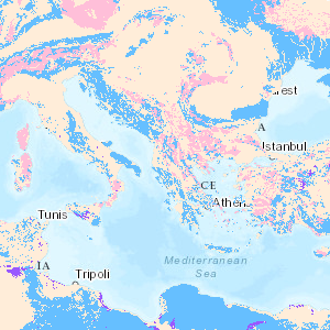
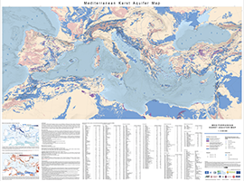
Karst aquifers constitute important freshwater resources, but are challenging to manage and to protect, because of their unique hydraulic structure and behaviour, representing continuous challenges for research and development. Karst aquifers are widespread and contribute to freshwater supply of most Mediterranean countries and many cities are supplied by karst water, e.g., Rome, Vienna, Montpellier and Beirut. These land surfaces correspond to the main recharge zones of karst aquifers, which are often hydraulically connected over large areas and are highly vulnerable to contamination. The preparation of the Mediterranean Karst Aquifer Map (MEDKAM) generally followed the workflow used for the World Karst Aquifer Map (WOKAM). A new lithological classification has been developed for the MEDKAM, similar to that of the WOKAM, which groups the geological units into four meaningful hydrogeological units: 1). Karst aquifers in sedimentary and metamorphic carbonate rocks. 2). Karst aquifers in evaporite rocks. 3). Various hydrogeological settings in other sedimentary and volcanic formations (karst aquifers are possibly present at depth). 4). Local, poor and shallow aquifers in other metamorphic rocks and igneous rocks (no karst aquifers present at depth). Karst-Aquifere enthalten oft wichtige Süßwasserressourcen, deren Bewirtschaftung und Schutz jedoch aufgrund ihrer einzigartigen hydraulischen Struktur und ihres Verhaltens eine Herausforderung für Forschung und Entwicklung darstellen. Karst-Aquifere sind weit verbreitet und tragen zur Süßwasserversorgung der meisten Mittelmeerländer bei, und viele Städte wie z.B. Rom, Wien, Montpellier und Beirut werden durch Karstwasser versorgt. Diese Landflächen entsprechen den Hauptanreicherungszonen von Karstgrundwasserleitern, die oft über große Gebiete hydraulisch miteinander verbunden sind und aufgrund ihrer hydraulischen Eigenschaften sehr anfällig für Verunreinigungen sind. Die Erstellung der Mediterranean Karst Aquifer Map (MEDKAM) folgte im Allgemeinen dem Arbeitsablauf, der für die World Karst Aquifer Map (WOKAM) verwendet wurde. Für die MEDKAM wurde eine neue lithologische Klassifikation entwickelt, die der der WOKAM ähnelt und die geologischen Einheiten in vier hydrogeologische Einheiten gliedert: 1).KarstAquifere in sedimentären und metamorphen Karbonatgesteinen. 2). Karstgrundwasserleiter in Evaporitgesteinen. 3). Verschiedene hydrogeologische Gegebenheiten in anderen sedimentären und vulkanischen Formationen (Karst-Aquifere sind möglicherweise in der Tiefe vorhanden). 4). Lokale, schlechte und oberflächliche Grundwasserleiter in anderen metamorphen Gesteinen und Eruptivgesteinen (keine Karstgrundwasserleiter in der Tiefe vorhanden).
Raumbezug
Lage der Geodaten (in WGS84)
| SW Länge/Breite | NO Länge/Breite | |
|---|---|---|
| -10.0°/26.0° | 49.0°/51.0° |
| Koordinatensystem |
|---|
Verweise und Downloads
Querverweise (1)
Nutzung
| Nutzungsbedingungen |
Creative Commons Namensnennung - Weitergabe unter gleichen Bedingungen 4.0 International (CC-BY-SA 4.0)Quellenvermerk: Xanke J, Goldscheider N, Bakalowicz M, Barberá JA, Broda S, Chen Z, Ghanmi M, Günther A, Hartmann A, Jourde H, Liesch T, Mudarra M, Petitta M, Ravbar N, Stevanovic Z (2022) Mediterranean Karst Aquifer Map (MEDKAM), 1: 5,000,000. Berlin, Karlsruhe, Paris. https://doi.org/10.25928/MEDKAM.1 Creative Commons Attribution-ShareAlike 4.0 International (CC BY-SA 4.0). Die bereitgestellten Informationen sind wie folgt zu zitieren / The information provided must be quoted as follows: Xanke J, Goldscheider N, Bakalowicz M, Barberá JA, Broda S, Chen Z, Ghanmi M, Günther A, Hartmann A, Jourde H, Liesch T, Mudarra M, Petitta M, Ravbar N, Stevanovic Z (2022) Mediterranean Karst Aquifer Map (MEDKAM), 1:5,000,000. Berlin, Karlsruhe, Paris. https: //doi.org/10.25928/MEDKAM.1 |
|---|
| Zugriffsbeschränkungen |
No access restrictions apply |
|---|
Kontakt
Fachinformationen
Informationen zum Datensatz
| Art des Dienstes |
View Service |
|---|
| Version |
OGC:WMS 1.3.0 |
|---|
| Fachliche Grundlage |
International Hydrogeological Map of Europe (BGR & UNESCO) |
|---|
Operation
| Name der Operation | Beschreibung der Operation | Aufruf der Operation | |
|---|---|---|---|
| GetCapabilities |
https://services.bgr.de/wms/grundwasser/medkam/? |
||
| GetCapabilities Dokument | Kartenansicht öffnen |
|---|
Zusatzinformationen
Konformität
| Spezifikation der Konformität | Spezifikationsdatum | Grad der Konformität | Geprüft mit |
|---|---|---|---|
| VERORDNUNG (EG) Nr. 976/2009 DER KOMMISSION vom 19. Oktober 2009 zur Durchführung der Richtlinie 2007/2/EG des Europäischen Parlaments und des Rates hinsichtlich der Netzdienste | 20.10.2009 | See the referenced specification |
Datenformat
| Name | Version | Kompressionstechnik | Spezifikation |
|---|---|---|---|
| WMS | OGC:WMS 1.3.0 |
Informationen zum Metadatensatz
| Objekt-ID |
15ae7cb1-b963-4e9b-8677-8df926405549 |
|---|
| Aktualität der Metadaten |
10.03.2025 |
|---|
| Sprache Metadatensatz |
Englisch |
|---|
| XML Darstellung |
|---|
| Point of Contact (Metadatum) |
|---|
| Metadatenquelle |
GeoDaK (Datenkatalog der Bundesanstalt für Geowissenschaften und Rohstoffe)
|
|---|---|
|
Bundesanstalt für Geowissenschaften und Rohstoffe
|


