
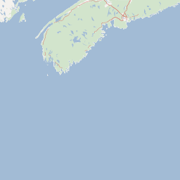
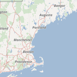
In the frame of the Continental Margin Study Program of the Federal Institute for Geosciences and Natural Resources (BGR, Hannover) marine geophysical measurements (48-channel reflection seismic, sono-buoy refraction, gravity and magnetic) were conducted over the Atlantic continental margin of Canada from 23th July to 7th August 1979 with S.V. EXPLORA (BGR79 leg 2). The survey on the Canadian continental margin was planned in cooperation between the Federal Institute for Geosciences and Natural Resources (BGR) and the Atlantic Geoscience Centre of the Geological Survey of Canada (Bedford Institute of Oceanography, Dartmonth, N.S.) on the base of existing Canadian multichannel seismic lines. A main target of the cruise was to acquire data which allow a comparison of the deep sedimentary basins offshore Nova Scotia with the already known basins offshore Morocco. The eastern part of the survey imaged complex structural deformation due to salt diapirs. The western seismic lines allowed to investigate the structural relationship between the Scotian Basin and the Georges Bank. Im Rahmen des Kontinentrand-Programms der BGR wurden vom 23. Juli bis 7. August 1979 marine geophysikalische Daten (Reflexionsseismik, Gravimetrie, Magnetik, Weitwinkelseismik) vor der Küste Nova Scotias erhoben. Die Fahrt BGR79 (2. Fahrtabschnitt) wurde in enger Kooperation mit dem Atlantic Geoscience Centre des Geologischen Dienstes Kanadas (Bedford Institute of Oceanography, Dartmonth, N.S.) geplant. Hauptziel der Fahrt war ein Vergleich der tiefen Sedimentbecken vor Nova Scotia mit den bereits bekannten vor Marokko. Im östlichen Teilgebiet der Fahrt wurden dabei komplexe Deformationsstrukturen abgebildet, die durch Salzdiapirismus ausgelöst wurden. Im westlichen Teilbereich erlaubten die Daten einen Vergleich zur Georges Bank.


Verweise und Downloads
Weitere Verweise (29)
| Identifikator des übergeordneten Metadatensatzes |
06a73c56-06a2-40d8-b806-466222b0760d |
|---|
Nutzung
| Nutzungsbedingungen |
Allgemeine Geschäftsbedingungen, siehe http://www.bgr.bund.de/AGB - General terms and conditions, see http://www.bgr.bund.de/AGB_en. Die bereitgestellten Informationen sind bei Weiterverwendung wie folgt zu zitieren: Datenquelle: BGR79/2 1979, (c) BGR, Hannover, 2018 |
|---|
| Zugriffsbeschränkungen |
no limitations to public access |
|---|
Kontakt
Fachinformationen
Informationen zum Datensatz
| Identifikator |
dd0fa6a4-782b-ac21-8ec7-10366dedea05 |
|---|
| Digitale Repräsentation |
Vector |
|---|
| Fachliche Grundlage |
During the period from the 23th July 1979 to the 7th August 1979 BGR acquired seismic lines in the Northwest Atlantic Ocean off the off the continental margin of Canada during the leg BGR79/2. The lines BGR79-105, BGR79-106, BGR79-108, BGR79-110, BGR79-116, BGR79-117, BGR79-122 and BGR79-123 are raw data. The lines BGR79-101, BGR79-102, BGR79-103, BGR79-104, BGR79-107, BGR79-109, BGR79-111, BGR79-112, BGR79-113, BGR79-114, BGR79-115, BGR79-118, BGR79-119, BGR79-120, BGR79-121, BGR79-124, BGR79-125, BGR79-126, BGR79-127, BGR79-128, BGR79-129, BGR79-130, BGR79-131, BGR79-132, BGR79-133, BGR79-134, BGR79-135 and BGR79-136 consist of stacked data. |
|---|
Zusatzinformationen
| Sprache des Datensatzes |
Englisch |
|---|
Konformität
| Spezifikation der Konformität | Spezifikationsdatum | Grad der Konformität | Geprüft mit |
|---|---|---|---|
| VERORDNUNG (EG) Nr. 1089/2010 DER KOMMISSION vom 23. November 2010 zur Durchführung der Richtlinie 2007/2/EG des Europäischen Parlaments und des Rates hinsichtlich der Interoperabilität von Geodatensätzen und -diensten | 08.12.2010 | siehe dazu die angegebene Durchführungsbestimmung |
Datenformat
| Name | Version | Kompressionstechnik | Spezifikation |
|---|---|---|---|
| Shapefile | n/a |
Schlagworte
| INSPIRE-Themen | Geology |
| GEMET-Concepts | geophysics Geophysik raw material Rohstoff |
| ISO-Themenkategorien | Geoscientific Information |
| Suchbegriffe | Marine geology Meeresgeologie Neuschottland Nordwest-Atlantik Northwest Atlantic Ocean Nova Scotia Scotian Basin Seismics Seismik Two-dimensional seismic reflection |
Informationen zum Metadatensatz
| Objekt-ID |
948de0cb-d60a-4bb0-9f45-f4990becceb1 |
|---|
| Aktualität der Metadaten |
14.11.2023 |
|---|
| Sprache Metadatensatz |
Englisch |
|---|
| Datensatz / Datenserie |
Dataset |
|---|
| XML Darstellung |
|---|
| Point of Contact (Metadatum) |
|---|
| Metadatenquelle |
GeoDaK (Datenkatalog der Bundesanstalt für Geowissenschaften und Rohstoffe)
|
|---|---|
|
Bundesanstalt für Geowissenschaften und Rohstoffe
|